Check our website features!
- Valuation lookup is more user friendly! Check it out here
- Google Maps are available on all property records
- Sales information on property records have been arranged to be more user friendly
- Subdivision sales search maps results. Just click "Map" on the results screen
- Now you can translate our site into over 50 languages
- Each property record has a link to the property's recent Real Estate Transfer Statements (Form 521s)
- An improved help page is available! Just click here
Geographical Information System (GIS)
The Geographic Information System (GIS) department manages cadastral parcel maps of all property in Douglas County. GIS works in conjunction with City of Omaha and in accordance with state statute to share this information with various government departments.
Our GIS technicians use sophisticated computer software combining aerial orthophotography and parcel map overlays to keep track of all real property in the county. Tied to the Assessor/Register of Deeds' property data system, parcel information can be organized, charted, and displayed in a myriad of combinations. This information is stored in a geodatabase.
The geodatabase in the hands of our geographic technicians not only serves the Assessor/Register of Deeds' office, but governmental subdivisions and individual property owners as well.
You can access aerial photographs of Douglas County with parcel overlays and property data by using Search by GIS Mapping.
To find the map of your property, first search for the property by going to Valuation Information. When you locate your property data, click on View Map. You can manipulate the visual layers with the controls on the right side of your screen. You can change the position of your property in relation to surrounding parcels by using the controls on the left.
For further information contact our GIS department at (402) 444-7060, Option 4 or by e-mail.
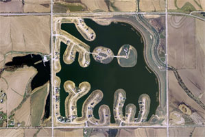
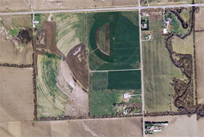
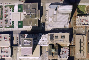
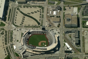
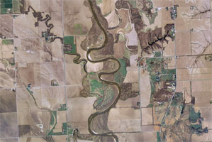
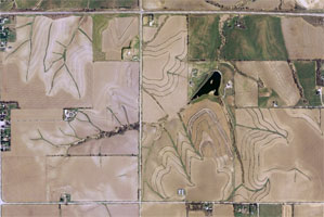
GIS aerial maps are not only a critical component of modern information management, but are also things of beauty. Here is just one more way of appreciating the visual diversity of Douglas County, Nebraska.
|
Bennington Lakes |
Center Pivot Irrigation |
|
Omaha’s Tallest Buildings |
The Home of the College World Series |
|
Meandering Elkhorn River |
Farm Terraces |